


Here are some more points to remember if you want to manage territories.
You can plot regions on the map based on files, location of regions, and drawing. Based on plotted regions, you can use the Alignment tool to select the required regions and create new territories. Also, you can plot the existing territories and copy or move them as required.
To perform territory management, click on Territory Management.
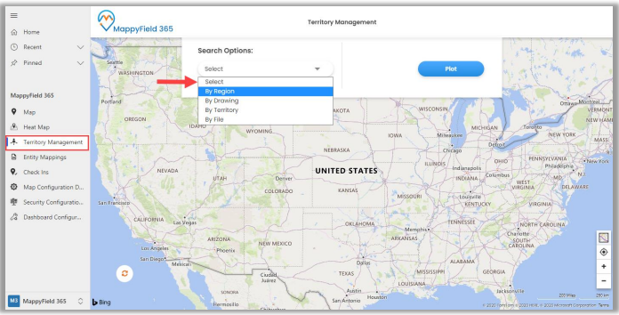
- Different search options available are By Region, By Drawing, By Territory, and By File.
- By Region: This option helps users search for regions on the map i.e., City, State, Country, and Postal Code.
- By Drawing: This lets you draw a shape using a custom drawing tool:
Union, Union Aggregate, Difference, Intersection, Disjunctive Union. You can perform the actions like Undo, Reset, and after performing the shape operation, the user can create the new territory of that resulting shape.
- By Territory: Using this option, you can plot existing territories on the map.
- By File: This option helps in plotting shape files. Supported file types are .shp, .kml, and .geojson.
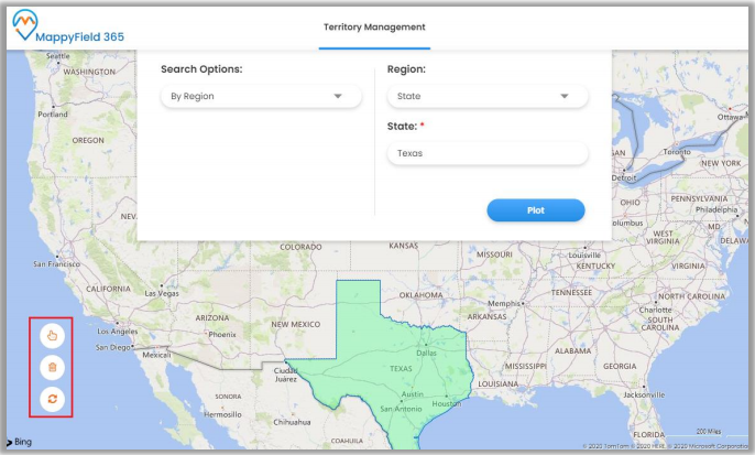
- After plotting, using the territory alignment tool, you can select/deselect territories as required on the map. Using the alignment tool, you can Select/Deselect, remove a selection or refresh the map.
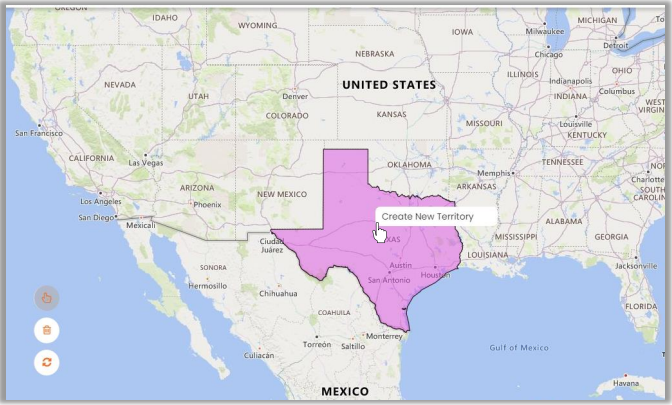
So to create a new territory, select a region/shape, and right-clicking on the selected region will show the option to create a new territory. Clicking on Create New Territory will open a dialog box to enter the territory name and select manager for a territory.
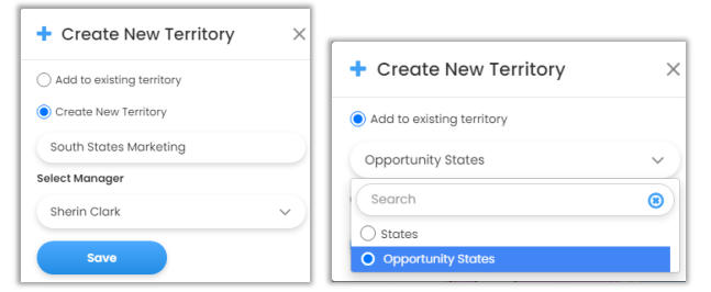
You can also add the new territory within the existing territory by selecting Add to the existing territory option. After inserting new territory or selecting the existing one, click on the Save button.
Using territory management, you can create new territories or manage existing territories directly from the map itself.